Using a new type of hyperspectral camera in the thermal infrared range, a team at Anhalt University of Applied Sciences is researching how environmental changes can be precisely recorded from the air. The technology should help to make soil changes or plant health visible. Even gas emissions can be recorded with the Telops Hyper-Cam Airborne Mini. In this interview, Prof. Dr. Marion Pause and Prof. Dr. Uwe Knauer explain the new ways in which the technology, which is funded by the German Research Foundation (DFG), can be used to adapt to climate change.
Climate change through the eyes from above | Part 2
-
 © hs anhalt | praxwerk
Until now, this sensor technology has mainly been used in the field of deposit exploration, i.e. mineralogy and geology, as well as the detection of gases in industrial or military environments.
Prof. Dr. Marion Pause
What is better to observe with the Telops Hyper-Cam Airborne Mini hyperspectral camera than with conventional thermal cameras?
Marion Pause: So far, this sensor technology has mainly been used in the field of deposit exploration, i.e. mineralogy and geology, as well as the detection of gases in industrial or military environments. As part of experimental campaigns, we now want to find out what potential the sensor technology offers us, for example in relation to plant health in Agriculture and issues in urban areas. For example, to quantify the evaporative cooling of plants and to look at interactions with other factors.
Uwe Knauer: " The camera system examines a wavelength range in which objects and gases emit electromagnetic radiation with a characteristic composition based on their temperature. These patterns allow us to analyze the environment in more detail than was previously possible.
The sensor is used on various aircraft as part of research projects. The great advantage of airplanes is their comparatively high range and area performance.
Prof. Dr. Uwe Knauer
How does this technology specifically help to counter the effects of climate change - for example in Agriculture or in urban areas?
Marion Pause: The ability to quantify ecosystem services and make land use in Agriculture and urban areas more climate-resilient are overarching goals.
Uwe Knauer: The emission of greenhouse gases can be measured with the system above a certain threshold, providing more precise insights into various processes that can then be improved.
How is the camera used?
Uwe Knauer: The sensor is used on various aircraft as part of research projects. The great advantage of airplanes is their comparatively high range and area performance. This means that larger research areas at home and abroad can also be studied more effectively.
How can high-resolution data be obtained and analyzed from the air?
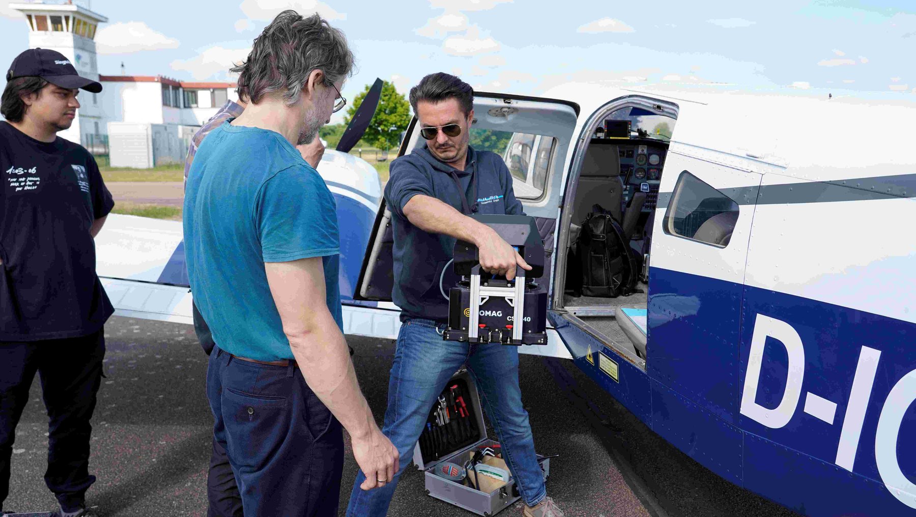
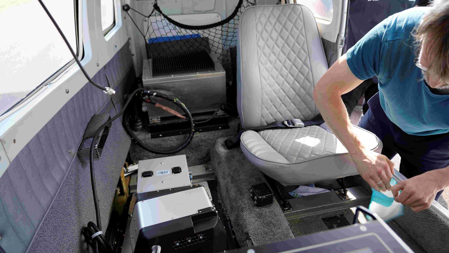
Uwe Knauer: The Hyper-Cam is very compact. The system consists of two components, can be installed in a prepared aircraft in about half an hour and only needs to be connected to a GPS antenna on the outside of the aircraft and the on-board power supply.
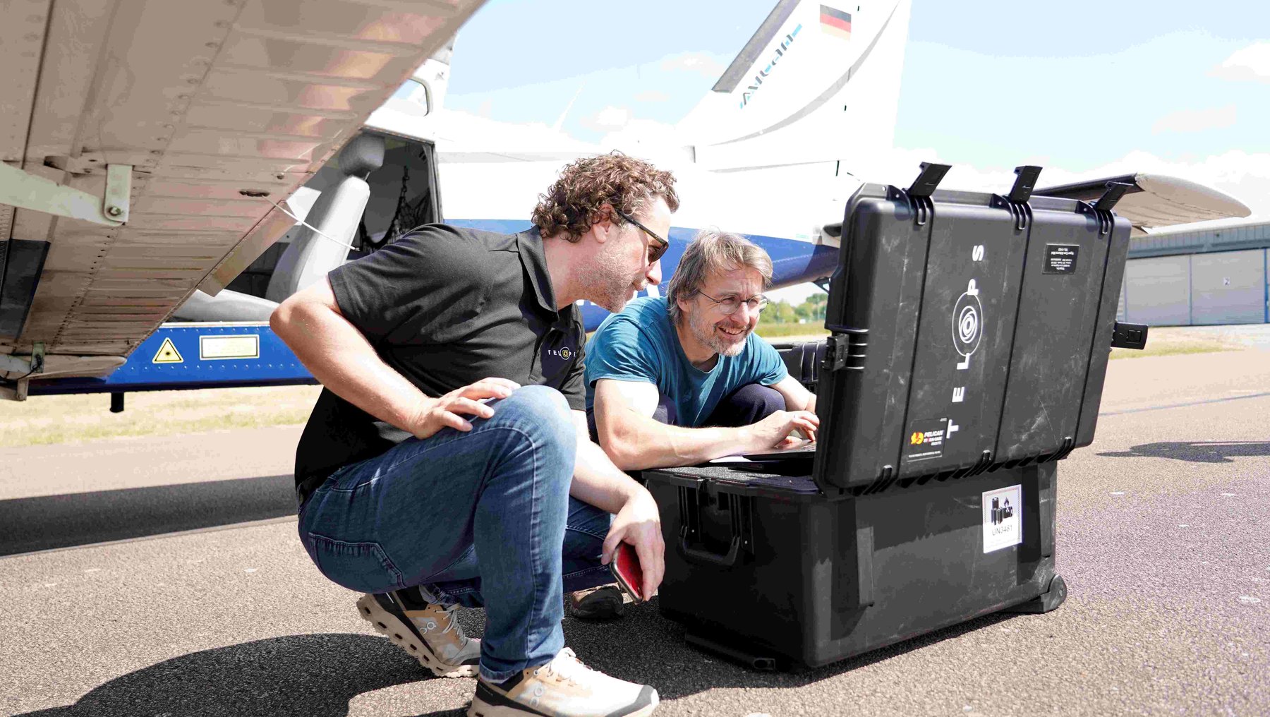
The areas to be surveyed have been planned on the computer beforehand. During the flight, an accompanying scientist monitors the current progress of the work on a laptop and recalibrates the system if necessary. Once the area has been overflown, the aircraft returns and the data is copied to an evaluation computer. After checking the data quality, an aerial map is calculated with the measured spectral signatures. These can then be used in the next step to derive thematic maps, for example on gas concentrations or the composition of surfaces.
-
 © hs anhalt | praxwerk
-
 © hs anhalt | praxwerk
-
 © hs anhalt | praxwerk
-
 © hs anhalt | praxwerk
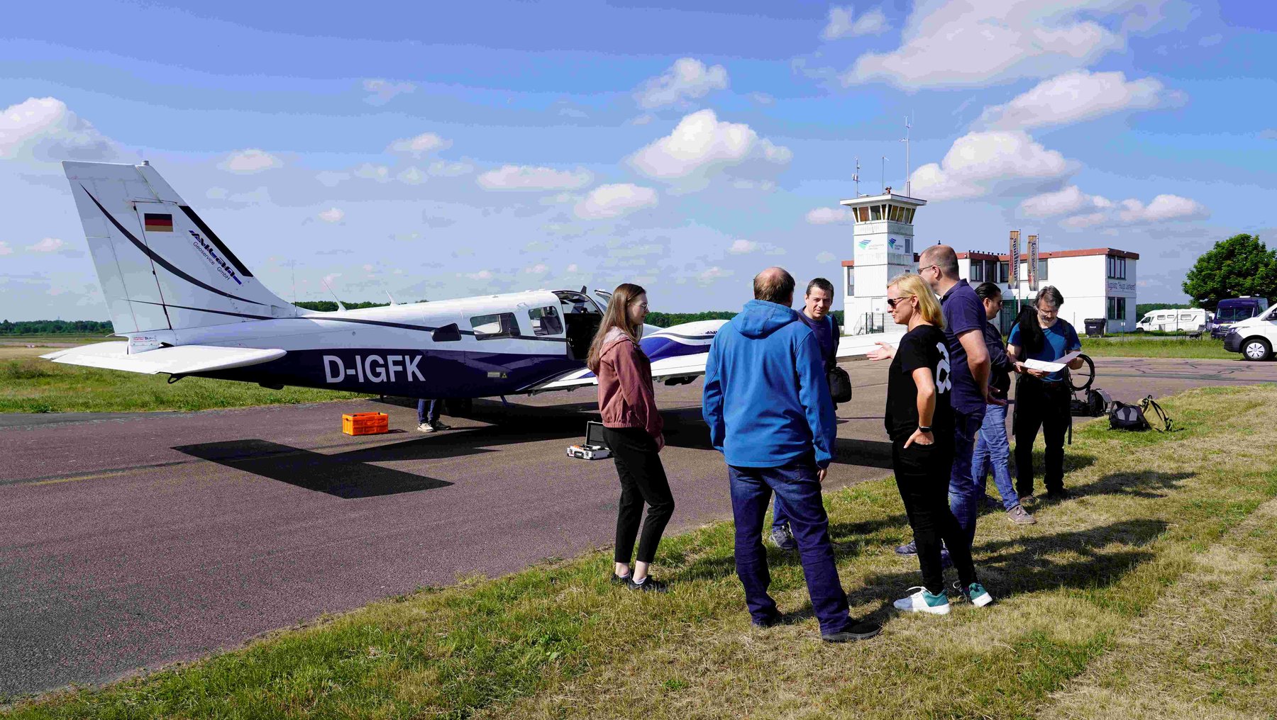
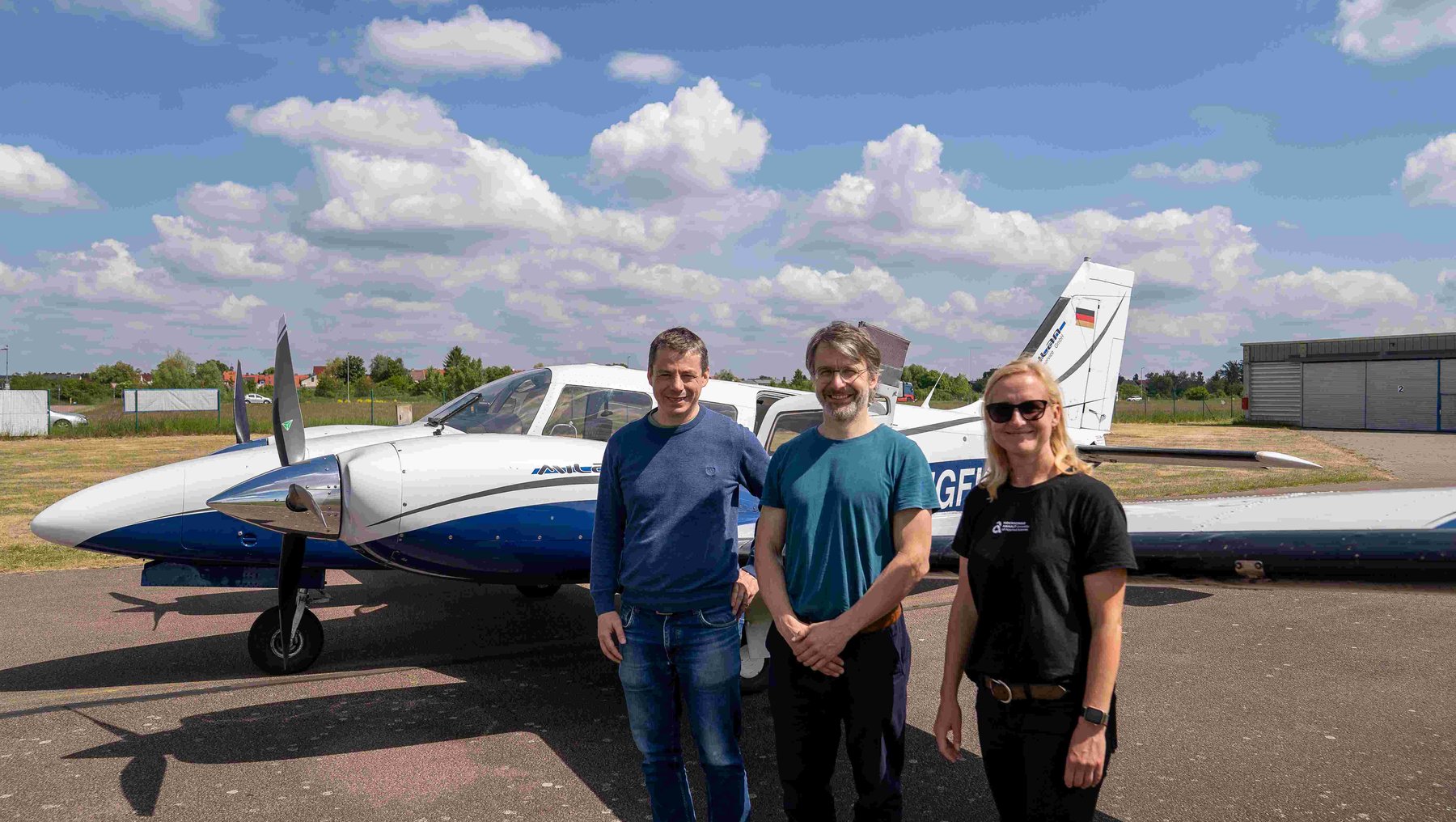
Dr. Bastian Sander (center) learned how the new hyperspectral camera is installed and used from the experts at Telops in mid-May. He is to carry out the remote sensing campaigns as an operator in future. Prof. Dr. Marion Pause (right) and Prof. Dr. Uwe Knauer (left) are currently discussing possible research questions with potential cooperation partners.
Will this also involve gas emissions? Which gases can be recorded, and what can be derived from them for environmental or climate protection?
Marion Pause: In principle, the sensor is suitable for detecting various gases such as methane and SF6 - sulphur hexafluoride. The practical conditions required for reliable detection, such as weather and gas concentration, will be investigated in future projects together with external partners from science and practice.
Uwe Knauer: It is also important to calibrate the system, i.e. we will often support the results with measurements carried out on the ground in order to achieve good results.
What role does interdisciplinary cooperation play in this project - especially with regard to the application of the technology?
Marion Pause: Interdisciplinary collaboration is key to generating new knowledge. For example, an expert from this field is always required to interpret the content of vegetation data relating to drought or heat stress in plants. The data is very sensitive to atmospheric conditions. Knowledge of physically based atmospheric models is therefore also required for targeted campaign planning and data evaluation.
Uwe Knauer: The technology can be used flexibly for different issues. Interdisciplinarity is the key to formulating interesting research questions and using the technology in different scientific disciplines. Not least in the evaluation of the data, geoinformaticians work closely with natural scientists, ecologists and practical partners who use the system to specifically search for new answers to research questions.
How far advanced are the preparations for the first missions and investigations? What steps are you planning in the near future?
Marion Pause: The sensor technology itself is basically ready for immediate use. We are currently trying to acquire third-party funding to initially finance a permanent research assistant, who will then also act as an operator for campaigns, among other things. Over the next few weeks, we will be using conference visits such as the EARSeL Symposium and the ESA Living Planet Symposium* to enter into personal exchanges with potential international and national cooperation partners. The aim is to apply for joint research projects. Ideally, there is even the possibility of initiating your own junior research group to establish the sensor in environmental research. In January 2026, we will offer a workshop at Campus Dessau and are planning our own session at an international conference.
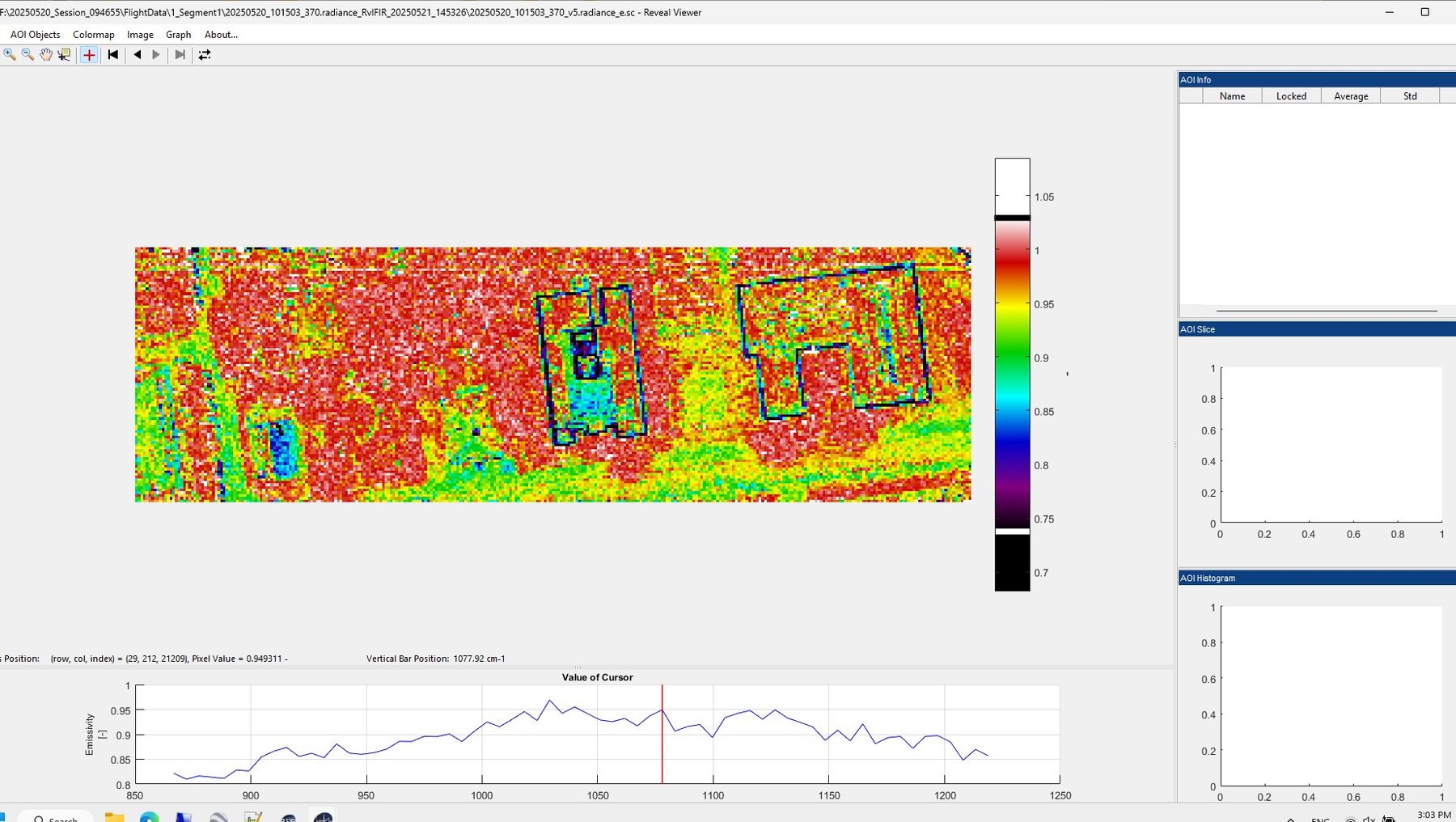
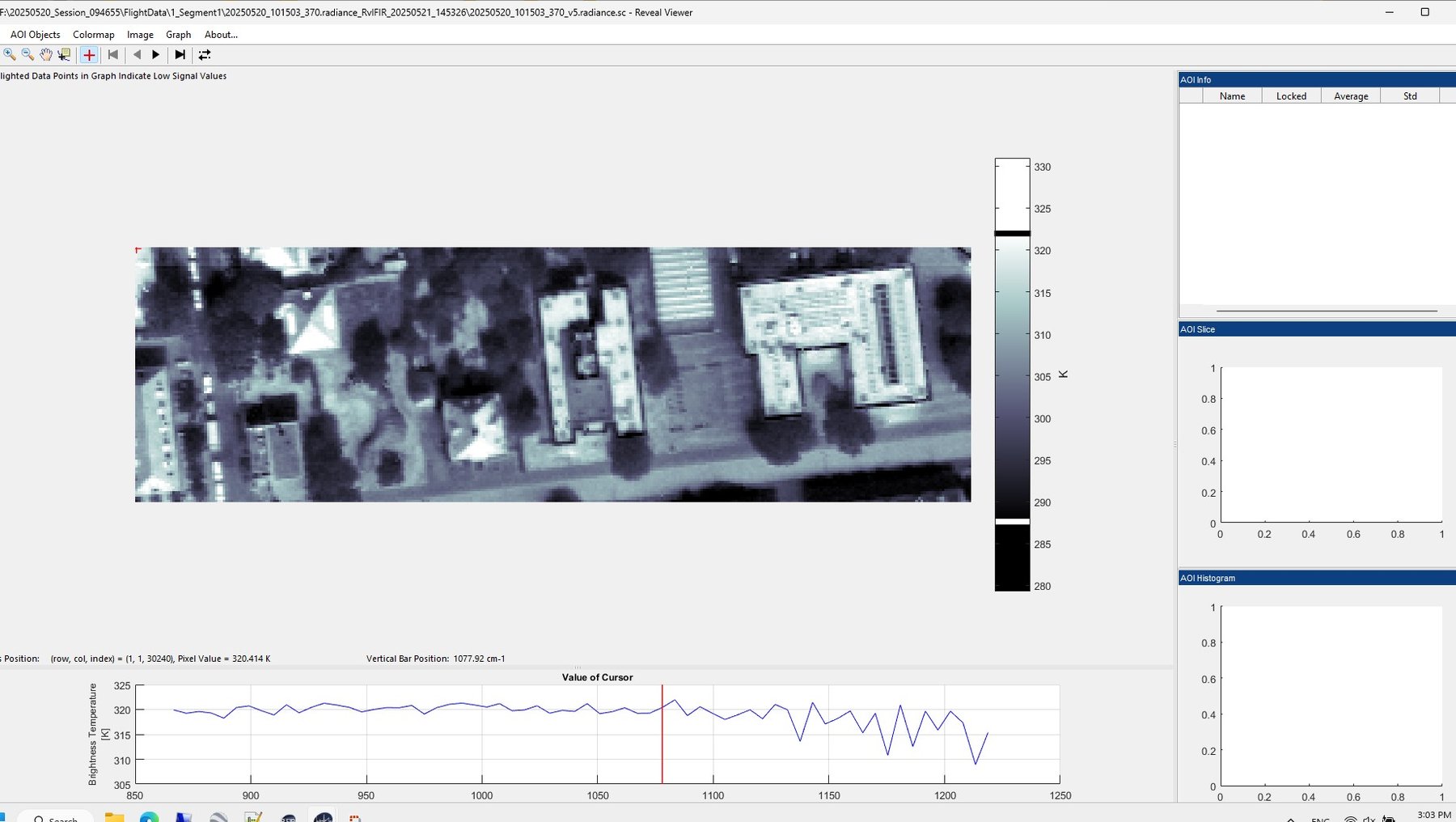
Uwe Knauer: Together, we were able to record the first data sets with the Hyper-Cam via Bernburg and Dessau. We are now testing the evaluation of this data and, of course, it is also available for initial analyses as part of projects and theses.
-
 © hs anhalt | praxwerk
-
 © hs anhalt | praxwerk
The first images from the test flights with the hyperspectral camera in mid-May show the Gauss House on the Campus Dessau of Anhalt University of Applied Sciences: with data on heat and radiation. The data will already be used for initial analyses as part of projects and theses.
Background | Info
Prof. Dr. Marion Pause...
- teaches and researches at Department of Architecture, Facility Management and Geoinformation 3 at Anhalt University of Applied Sciences
- studied geodesy at the TU Dresden and completed her doctorate at the Ludwig Maximilian University of Munich in the field of multi-sensor remote sensing
- is scientifically and practically involved in capturing and evaluating data using photogrammetry and remote sensing imaging technologies
- coordinates measurement campaigns and research projects using the university's own research gyrocopter, including in cooperation with the Helmholtz Center for Environmental Research in Leipzig
- More information on her personal page: https://www.hs-anhalt.de/hochschule-anhalt/service/personenverzeichnis/person/dr-marion-pause.html
Prof. Dr. Uwe Knauer...
- teaches and researches at Department of Agriculture, Ecotrophology and Landscape Development 1 at Anhalt University of Applied Sciences
- studied computer science at the Humboldt University of Berlin, where he completed his doctorate and specialized in the analysis of image data using machine learning methods in the teaching and research field of signal processing and pattern recognition
- conducts research at Anhalt University of Applied Sciences in various projects on digital technologies in plant production, including "TRANSFORM", "DiPredict", "AgriRestore" and "DIP:DiPisum"
- More information on his personal page: https://www.hs-anhalt.de/hochschule-anhalt/service/personenverzeichnis/person/prof-dr-uwe-knauer.html
The project at current symposia...
The hyperspectral camera Telops Hyper-Cam Airborne Mini could be procured at Anhalt University of Applied Sciences thanks to funding from the German Research Foundation (DFG) (DFG-Großgeräte 2022). The project follows on from numerous previous remote sensing projects at Anhalt University of Applied Sciences: https: //www.hs-anhalt.de/projekte/projekt/fb1-hytir-prof-dr-uwe-knauer-forschungsprojekt.html
The research team led by Prof. Dr. Marion Pause and Prof. Dr. Uwe Knauer is currently carrying out initial test flights and coordinating potential research questions with future cooperation partners - including at the 44th EARSeL Symposium and the ESA Living Planet Symposium:
- The 44th EARSeL Symposium took place in Prague at the end of May 2025. It offers experts an international platform and is the annual meeting of the European Association of Remote Sensing Laboratories(https://symposium.earsel.org/44th-symposium-Prague/).
- This year, the European Space Agency (ESA) is organizing the Living Planet Symposium in Vienna from 23 to 27 June. Every three years, experts meet at this specialist event to discuss issues relating to Earth observation. Focus 2025: the transition from "observation to climate action and sustainability for the Earth" (
- https://lps25.esa.int/).
On January 22 and 23, 2026, the team is offering a workshop: Research and applications of airborne FTIR spectroscopy for the environment. You can register on this page: https: //www.hs-anhalt.de/fachbereiche/loel/aktuelles/airborne-ftir/welcome.html
Redaktion
Prof. Dr. Marion Pause...
... is available for inquiries and requests by phone: +49 (0) 340 5197 1564 or by e-mail: marion.pause(at)hs-anhalt.de
Prof. Dr. Uwe Knauer...
... can be reached for questions and inquiries by phone: +49 (0) 3471 355 1278 or by e-mail: uwe.knauer(at)hs-anhalt.de
The current joint publication on the topic
... has been published here: HyTIR : an airborne hyperspectral imaging research platform in the LWIR wavelength range / Knauer, Uwe *1976-*. - Contained in Int. Arch. Photogramm. Remote Sens. Spatial Inf. Sci., XLVIII-M-7-2025: , vol. XLVIII-M-7-2025 (2025), pp.157-162. doi. org/10.5194/isprs-archives-XLVIII-M-7-2025-157-2025
Upcoming stations of the project
... ESA Living Planet Symposium from June 23 to 27 in Vienna for network development
... in planning: Workshop on January 22/23 in Dessau and own session at international conference in January 2026
The first article in this series on the Anhalt University of Applied Sciences climate blog can be found here: https: //www.hs-anhalt.de/hochschule-anhalt/aktuelles/neuigkeit-1/klimawandel-mit-den-augen-von-oben-teil-1.html
