Images taken from a distance can provide important information on climate change: changes in vegetation, heat islands in urban areas, or drought stress in forests. To promote the widespread use of remote sensing data, Anhalt University of Applied Sciences is conducting research through various projects. We’re featuring the people involved and the topics on our climate blog. We’re kicking things off with an interview with Marion Pause, professor of photogrammetry and remote sensing at the Campus Dessau.
Climate Change Seen from Above | Part 1
-
 © hochschule anhalt | Marvin Gabler

We already have many technical capabilities and access to a wealth of footage from satellites, gyrocopters, and drones. The challenge now is to put this to good use with our users.
Professor Pause, what images taken from a distance have you been working with most recently? How were they captured, what did they show, and what did you do with them?
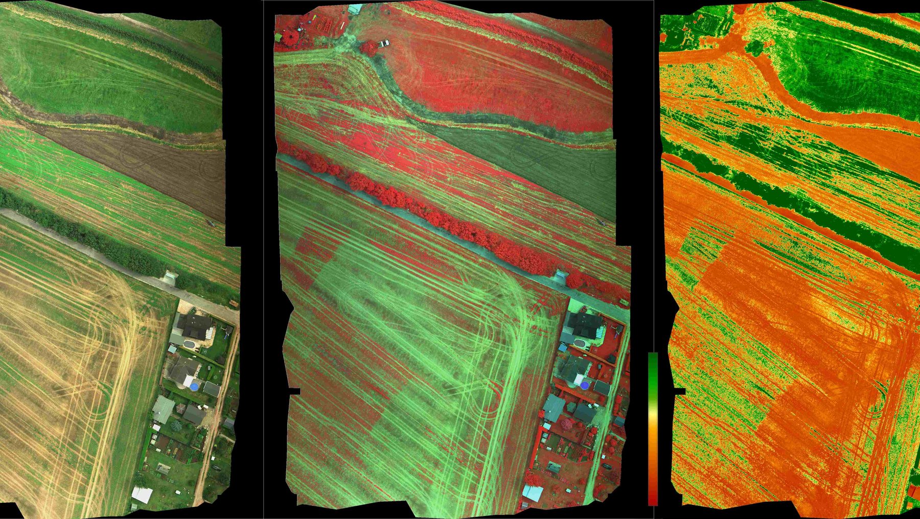
For example, we collected thermal data—so-called thermal imagery—from the Dessau urban area using the research gyrocopter from Anhalt University of Applied Sciences. Here, we can clearly see the cooling effect of urban trees in built-up areas and how areas with a high degree of impervious surface act as heat islands. Our research focuses on improving the interpretive value of such image data, which reveals complex physical processes. To make thermal data usable, various corrections are necessary—for example, to plausibly document temporal and spatial changes in the thermal properties of urban areas.
Why is research on remote sensing important?
We already have many technical capabilities and access to a wealth of imagery from satellites, gyrocopters, and drones. The challenge now is to make the most of these images, and to do so, we need more questions from users—in the fields of urban development, Agriculture, forestry, and nature conservation. In many cases, what we’re capable of and what’s needed still need to be brought together.
 © Marion Pause
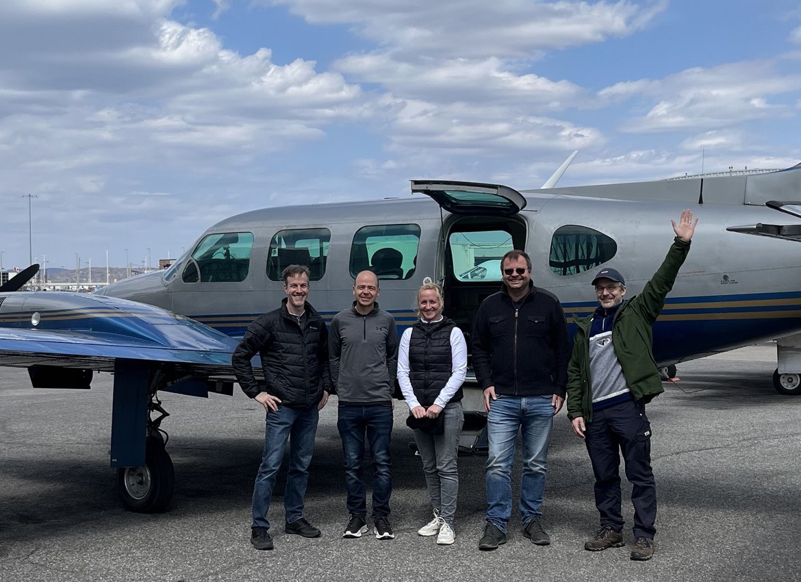
Prof. Marion Pause in Canada: In April, she participated in a training session here alongside Bastian Sander from Anhalt University of Applied Sciences (far right). The training focused on the use of a new remote sensing sensor that Prof. Marion Pause and Prof. Uwe Knauer from the Campus Bernburg-Strenzfeld plan to use in future joint research projects.
One of your recent publications deals with monitoring the vegetation and geodiversity of the Earth's surface in the context of climate change. Why is this important?
With the help of what is known as imaging remote sensing, we have a unique opportunity to document changes in the land surface and their spatial patterns—and thus also the interplay of various factors! This includes, for example, the interaction between green, urban infrastructure—such as city trees and hedges—and heat stress. In agricultural landscapes, the focus is on revealing large-scale relationships and quantifying them using data—for example, soil moisture and biodiversity in relation to land use and land-use change. This is important for providing decision-makers with a robust data foundation to implement sustainable climate adaptation measures and to foster understanding and acceptance within society.
For example, what could be monitored using the approach you described?
Remote sensing allows us to reliably document the impact of measures aimed at enhancing climate adaptation and biodiversity for the benefit of society. For example, we could monitor how the intensive planting of hedgerows affects the soil, the water cycle, soil quality, and biodiversity in agricultural landscapes. In urban areas, we can monitor how urban greening measures or the selection of specific building materials affect thermal stress in residential areas.
In your opinion, to what extent is the potential of remote sensing currently being utilized?
I’d say only a fraction. There are several reasons for this: The potential of remote sensing is still relatively new and has yet to be integrated into monitoring processes. We also want to contribute to this through our academic programs. Furthermore, through practical projects, we can further build support and demonstrate how remote sensing can be used in concrete ways.
Among other things, you are participating in the collaboration with the city of Dessau-Roßlau for BUGA 2035. To what extent does remote sensing come into play here?
We’re currently still in the planning phase for our upcoming projects. But we’ll definitely be using our gyrocopter for aerial surveys and data collection. For example, we might look at where the city heats up the most and where countermeasures—such as planting greenery—should be taken. Cities are currently interested in how their green spaces are developing. This, too, can be observed very good using footage from the gyrocopter. Ideally, this collaboration will (among other things) serve as a blueprint for what can be achieved with digital tools in urban planning and development. That’s why we’re taking an interdisciplinary approach, collaborating with the Sustainable Urban Development degree program as well as colleagues from the landscape architecture department in Bernburg.
You conduct research on both the technical aspects of remote sensing and specific applications. Which is more important to you?
Both equally. I also see the fact that we combine technological developments—particularly remote sensing using gyrocopters equipped with the appropriate camera technology—so closely with real-world applications as a unique selling point of Anhalt University of Applied Sciences.
Prof. Dr. Marion Pause…
- teaches and conducts research in Department 3 at Anhalt University of Applied Sciences: Architecture, Facility Management and Geoinformation
- studied geodesy at TU Dresden and earned a Ph.D. in the field of multisensory remote sensing at Ludwig Maximilian University of Munich
- is involved in both the scientific and practical aspects of collecting and analyzing data using imaging technologies such as photogrammetry and remote sensing
- Coordinates measurement campaigns and research projects using the university’s own research gyrocopter, including in cooperation with the Helmholtz Center for Environmental Research in Leipzig
- For more information, visit her personal page: https://www.hs-anhalt.de/hochschule-anhalt/service/personenverzeichnis/person/dr-marion-pause.html
Remote Sensing at Anhalt University of Applied Sciences:
Research is being conducted at the Campus Bernburg-Strenzfeld of Anhalt University of Applied Sciences to explore how remote sensing data can support Agriculture and nature conservation. We will feature the researchers, topics, and projects in future articles on the Climate Blog.
Redaktion
Prof. Dr. Marion Pause
... can be reached for questions and inquiries by phone at +49 (0) 340 5197 1564 or by email at marion.pause(at)hs-anhalt.de
... recent publication: Monitoring vegetation and geodiversity with remote sensing and traits / Lausch, Angela. - Included in: Philosophical Transactions of the Royal Society, Vol. 382 (2024). DOI: https://royalsocietypublishing.org/doi/10.1098/rsta.2023.0058
... more about her research topics and responsibilities at Anhalt University of Applied Sciences at the end of the interview
