A field with a hedge, a field without one. With climate change, this question has regained importance for Agriculture: Can hedges—that is, woody structures of varying sizes—help keep soils moist and yields stable? Josef William Palmer, a doctoral candidate at Anhalt University of Applied Sciences, is investigating this as part of the AgriRestore project.
Hedges in Agriculture: A View from the Air
-
 © hochschule anhalt | josef w. palmer
Welche Auswirkungen haben Hecken auf landwirtschaftliche Flächen? Ein Doktorand an der Hochschule Anhalt sucht mit Hilfe der Fernerkundung nach Antworten.
“What fascinates me most about remote sensing is the view of Earth from a different perspective,” says Palmer, who recently earned his master’s degree in Prof. Dr. Marion Pause’s research group. His focus: remote sensing and photogrammetry. In this regard, he knows all too well: “Structures and relationships sometimes only become clear from the air.” With the help of special sensors, images can be generated that are invisible to the human eye. Palmer is utilizing these technical capabilities in his doctorate for the AgriRestore project, which investigates which measures can revitalize and strengthen agricultural habitats.
-
 © hochschule anhalt | josef w. palmer
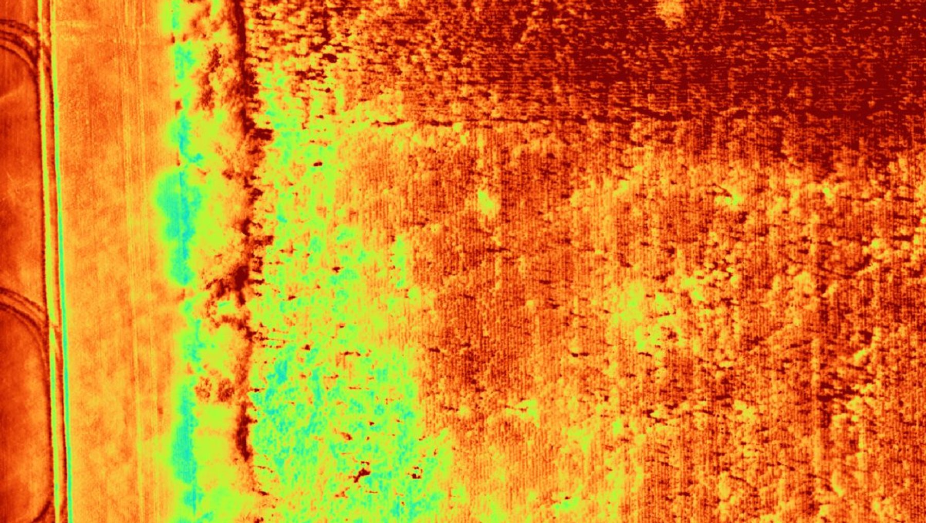
Die thermischen Daten weisen bereits auf unterschiedliche Bodenverhältnisse hin. In der Nähe der Hecke und in ihrem Schatten sind die Temperaturen deutlich niedriger. -
 © hochschule anhalt | josef w. palmer
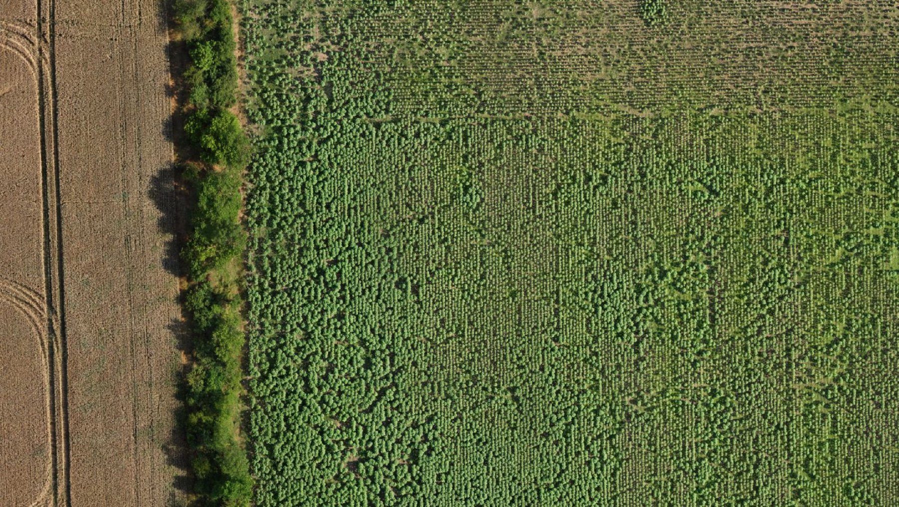
Das Feld mit der Hecke aus der Luft, wie es das Auge sieht.
One Day and Three Flights: Hedges in Agriculture
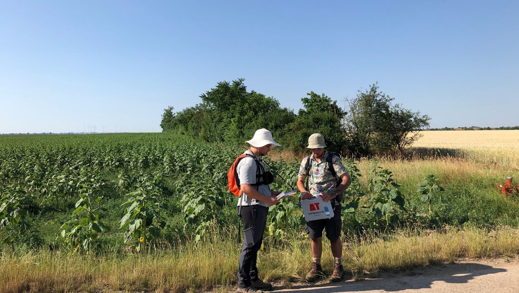
On June 25, Josef William Palmer began the aerial surveys together with a team from the Dessau airfield. The target areas were farmlands near Calbe (Saale) that belong to agricultural partner farms of the AgriRestore project. An aircraft equipped with a hyperspectral sensor flew over the fields, while Palmer simultaneously operated a drone to collect validation data.
In total, the team conducted three flights that day: in the morning, at noon, and in the afternoon. The goal was to determine how the individual field sections behave over the course of the day and how the plants react to changing conditions (light, temperature, and water availability).
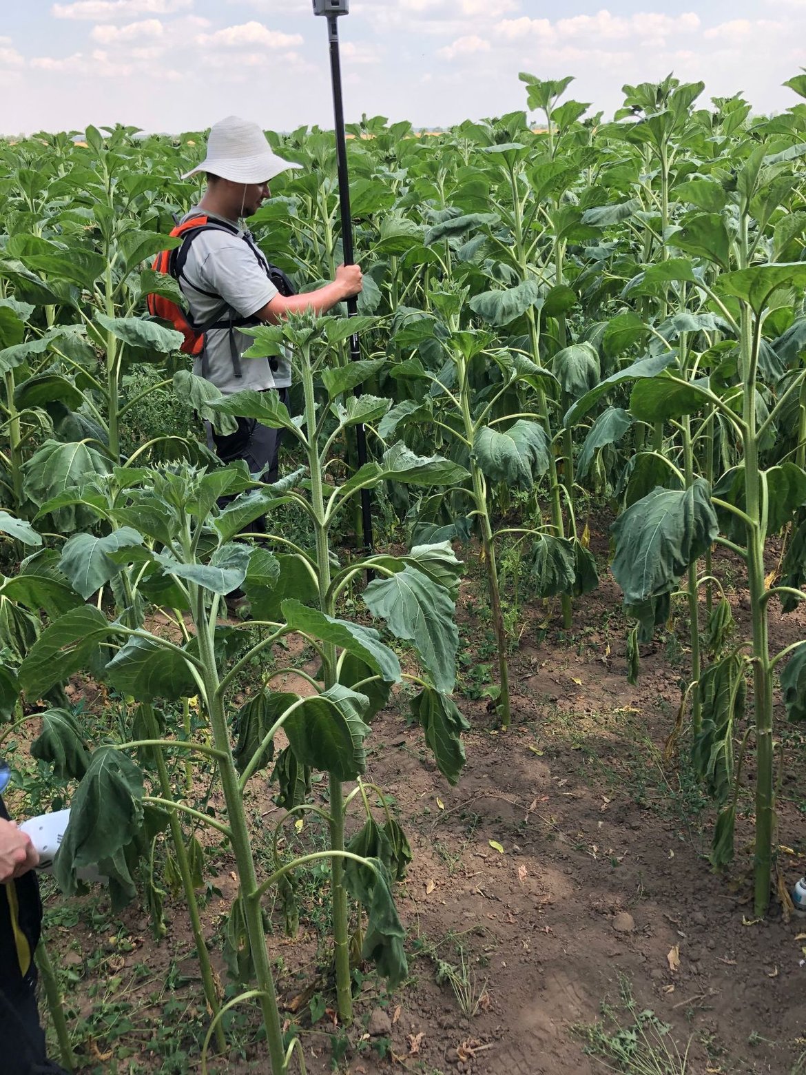
The team collected various measurements: soil parameters such as moisture content and plant vital signs such as plant height and leaf spacing. “This allows us to test the hypothesis that woody plants influence how the soil and plants develop,” explains Palmer. The field in Calbe (Saale) was very good for this purpose: “The woody plant structures here varied greatly—from lush to completely absent.”
 © hochschule anhalt | josef w. palmer
Big Data – Unanswered Questions for Agriculture and Remote Sensing
By the end of the day, the team had collected 500 gigabytes of raw data. Analysis is currently underway. The results will be included in several papers that Palmer will write as part of his doctorate. His work thus covers two areas in which there has been little research to date: On the one hand, there is still little reliable data on how woody plants can benefit Agriculture—as water reservoirs, habitats for insects, or erosion control. Second, the dissertation explores a technology for Agriculture that has primarily been used for military purposes until now: hyperspectral data in the thermal infrared range. Both the purchase of the Telops Hyper-Cam Airborne Mini and the AgriRestore project were funded by the German Research Foundation (DFG).
From a Bachelor's Degree to a Doctorate
For Josef William Palmer, these conditions also align on a personal level. As a result, after completing his bachelor’s thesis, he was able to pursue not only a master’s degree in a subject that fascinates him, but also a doctorate. His master’s thesis was honored as the best of his class in July at the Geodetic Colloquium. Not least, his hometown of Dessau connects him to the university. “At the same time, my doctorate allows me to experience just how diverse the geosciences can be,” Palmer says, looking back on the international conference, the European Geosciences Union General Assembly (EGU), held in Vienna in April of this year. In the “Thermal Infrared (TIR) Remote Sensing” session, he and his colleagues presented the initial results from Hyper-Cam. “In this session alone, there was a wide range of topics, including volcanism, and I was able to make new connections with colleagues from other countries and thus exchange experiences.”
Learn more about Josef William Palmer on his personal page: https://www.hs-anhalt.de/hochschule-anhalt/service/personenverzeichnis/person/josef-william-palmer.html
Facts and figures about the AgriRestore project: https://www.hs-anhalt.de/projects/project/research-initiatives-16-restoration-of-ecosystems-and-landscapes-across-various-spatial-and-temporal-scales-to-promote-biodiversity-and-climate-resilience-in-agricultural-landscapes-prof-dr-christina-fischer.html
Facts and Data on HyTIR - Telops Hyper-Cam Airborne Mini: https://www.hs-anhalt.de/projekte/projekt/fb1-hytir-prof-dr-uwe-knauer-forschungsprojekt.html
Redaktion
Claudia Aldinger
The AgriRestore project is addressing issues that have become essential to Agriculture. Among other things, the interdisciplinary team is investigating the effect of wildflower strips and hedge structures. The research is funded by the DFG: https://www.hs-anhalt.de/projekte/projekt/forschungsimpulse-16-wiederherstellung-von-oekosystemen-und-landschaften-ueber-verschiedene-raeumliche-und-zeitliche-skalen-promoting-biodiversity-and-climate-resilience-in-agricultural-landscapes-prof-dr-christina-fischer.html
